Lushoto to Mount Kilimanjaro & Enduimet, August 2023
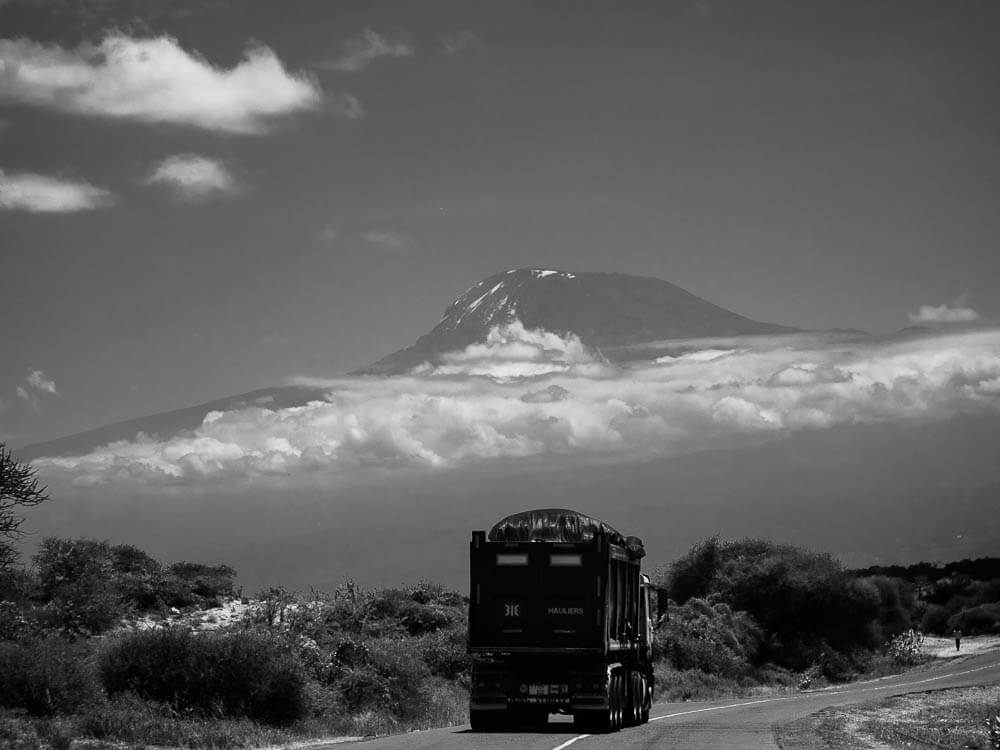
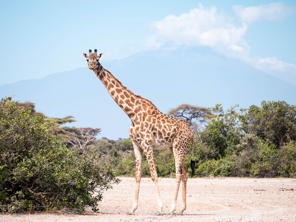
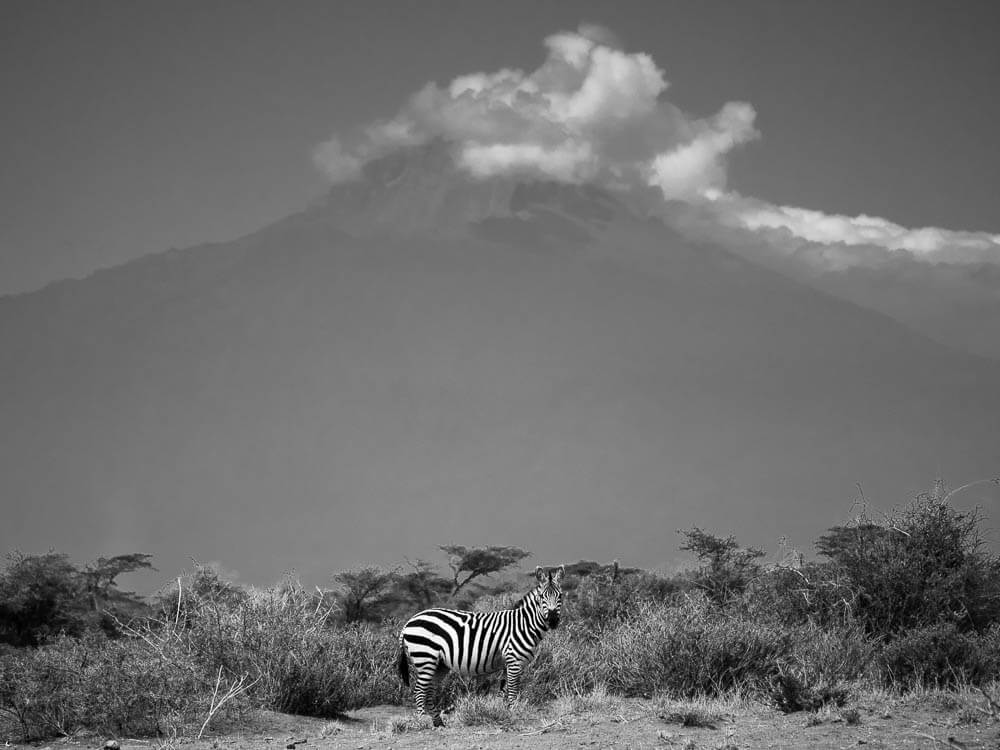
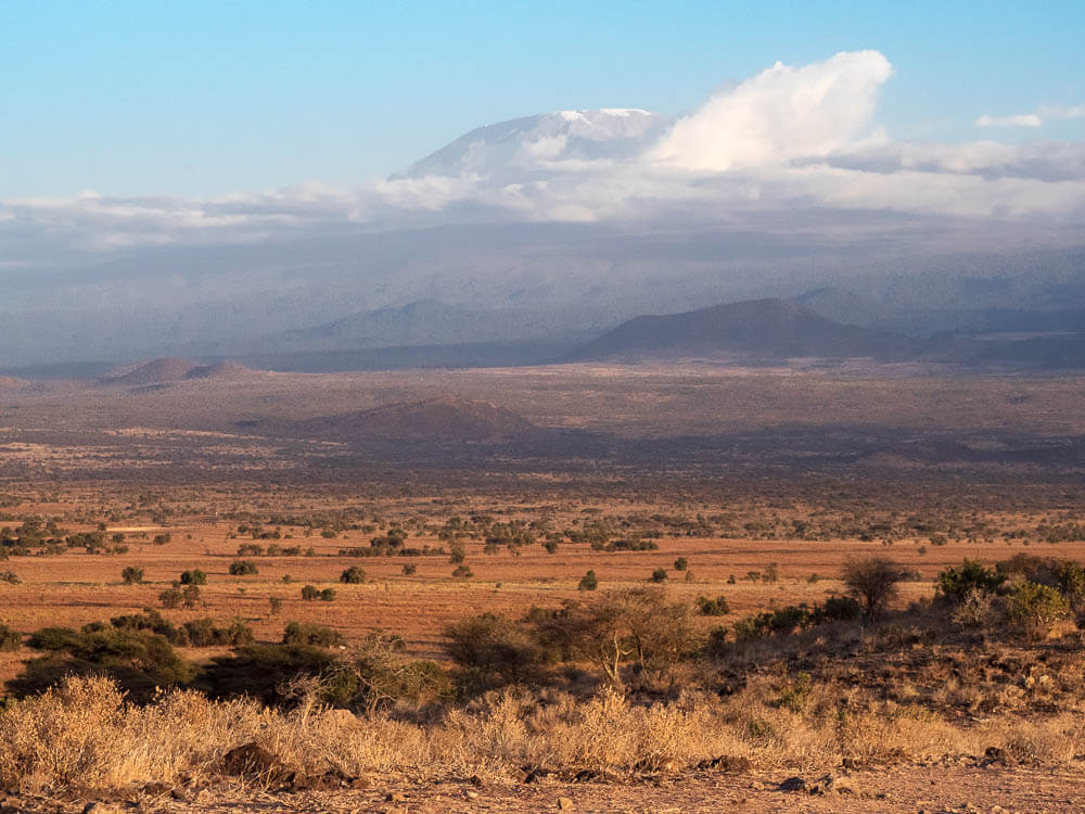
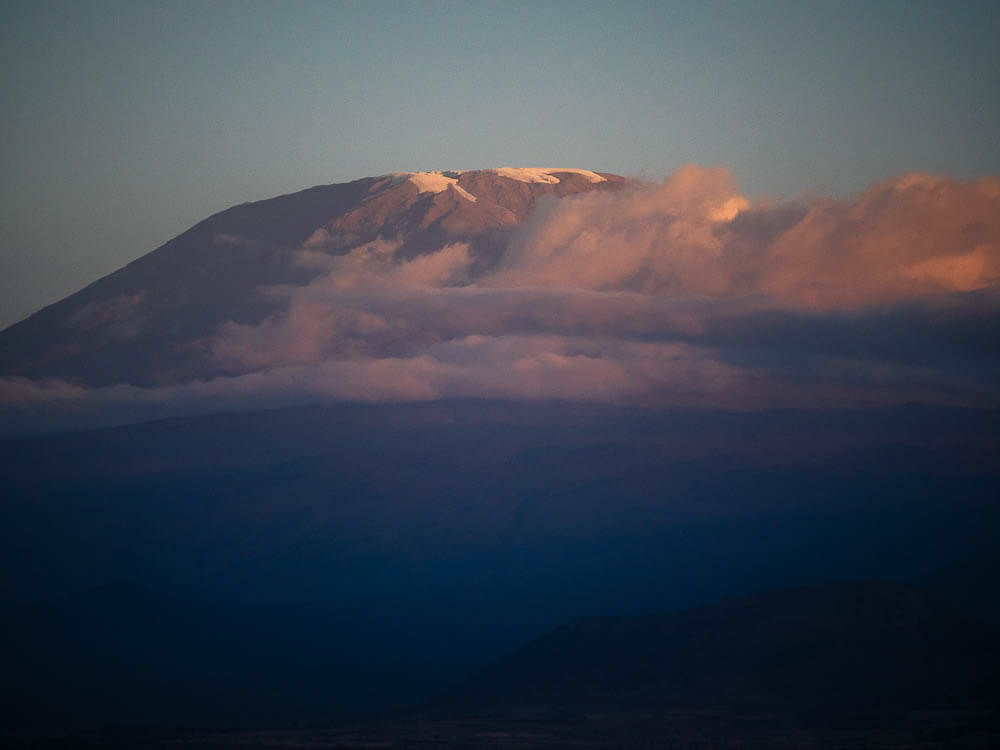
Taking a right at Mombo, we drive past the penultimate Eastern Arc Mountains via the Maasai Plains. Past a sisal plantation and over a rise, we’re greeted by the breathtaking sight of Mount Kilimanjaro. The gods have smiled on us as there is only a small ring of cloud on the middle section of the volcano. It towers, almost unbelievably high, out of the plains below. The peak and most of Mt. Kilimanjaro is well defined and completely visible to us as we drive towards the mountain and Moshi. Many tourists have to wait days and sometimes weeks to get a decent view of the mountain. The highest section of Kilimanjaro, Uhuru Peak, rises 5,000 metres further above us with the legendary and diminishing equatorial snow crowning the scene. A not insignificant 5km Park Run.
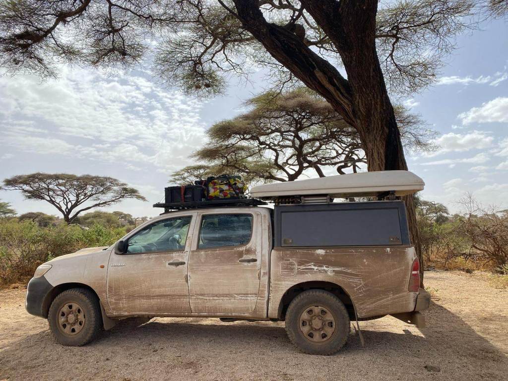
Moshi town offers us a chance to restock and we gratefully fill up on milk sachets, coffee, indeterminate sausages along with some chocolaty odds and ends. It turns out later that I mistakenly buy sachets of sour milk instead of milk. We drive around the town for a while looking for accommodation but quickly come to the realisation that there isn’t much of interest to us in town. Instead, our hilux heads further west. We have an idea to camp at a place called Simba Farm on the west side of Kilimanjaro. If possible, we want to drive all the way around the dormant volcano.
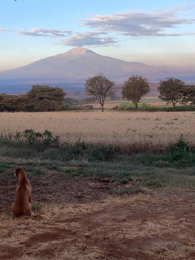
Simba Farm is really nice. We spend a few days lazing in the campsite with a nightly bbq of supplies purchased from the well stocked farm shop. We can’t actually see Mt Kilimanjaro from our location but we do get to see Mt Meru across the plains and enjoy the view in the sunset each evening. We’re also able to run along the farm roads in amongst the wheat fields at a height of about 1,750 metres, making our chests a little breathless.
We are budget travellers trying to keep as close to a budget of US$30 per day. We are all too often lying to ourselves about achieving this daily spend if we include fuel, border crossings and additional activities like national parks etc and so have designated a separate bonus pot for national parks and wildlife. The bonus pot for East Africa is enough for maybe 3 national parks and some snorkelling or dive activities on the coast. We decide that Kilimanjaro NP costs will be too much of a hit and will affect our aim of getting to the Maasai Mara. Instead, after checking it is possible with the farm staff, we decide to drive all the way around Kilimanjaro. There is an added bonus in that there is a wildlife management area (WMA) along the way called Enduimet. It has much lower costs for entry and camping than the Kilimanjaro NP and is part of the Amboseli ecosystem.
We leave Simba Camp in the early morning heading north and the tar road disappears shortly afterwards. Small communities of Maasai along the way are herding very healthy looking cattle in the harvested wheat fields.
The Enduimet WMA is an initiative which was granted official status in 2007. The area is an important piece of the wildlife corridor running between Kenya and Tanzania linking up to the Kitenden wildlife corridor and Amboseli National Park. The communities of the WMA are predominantly Maasai people and they gain a share of the revenue from tourism although it has been noted that the overall revenue and share is quite low relative to potential results.
The gate of Enduimet WMA is a pleasant experience and we chat to two friendly Maasai WMA staff who are managing entry. Costs are a third compared to national park entries and we readily agree to stay overnight in their camp as overnight entry makes it even cheaper. We are given a decent but hand-drawn, photocopied map along with an interesting write up of the area, and head in for one night and two days of exploration.
The dirt road is fairly good and we bounce along passing a few local Maasai people traditionally dressed as well as two more locals on a motorbike. The WMA works by turning the community space and lands into a safe space for wildlife. In other words, the normal Maasai community activity happens, but in and amongst the wildlife with the community agreement that the wildlife will be protected. There is however, to my understanding, a hunting concession in a section of the WMA utilised by foreign hunters.
Soon after passing the two locals on motorbike, we take a right turn away from a small Maasai village. We were specifically told to try and not disturb the village and keep to the wildlife areas by the gate administrators.
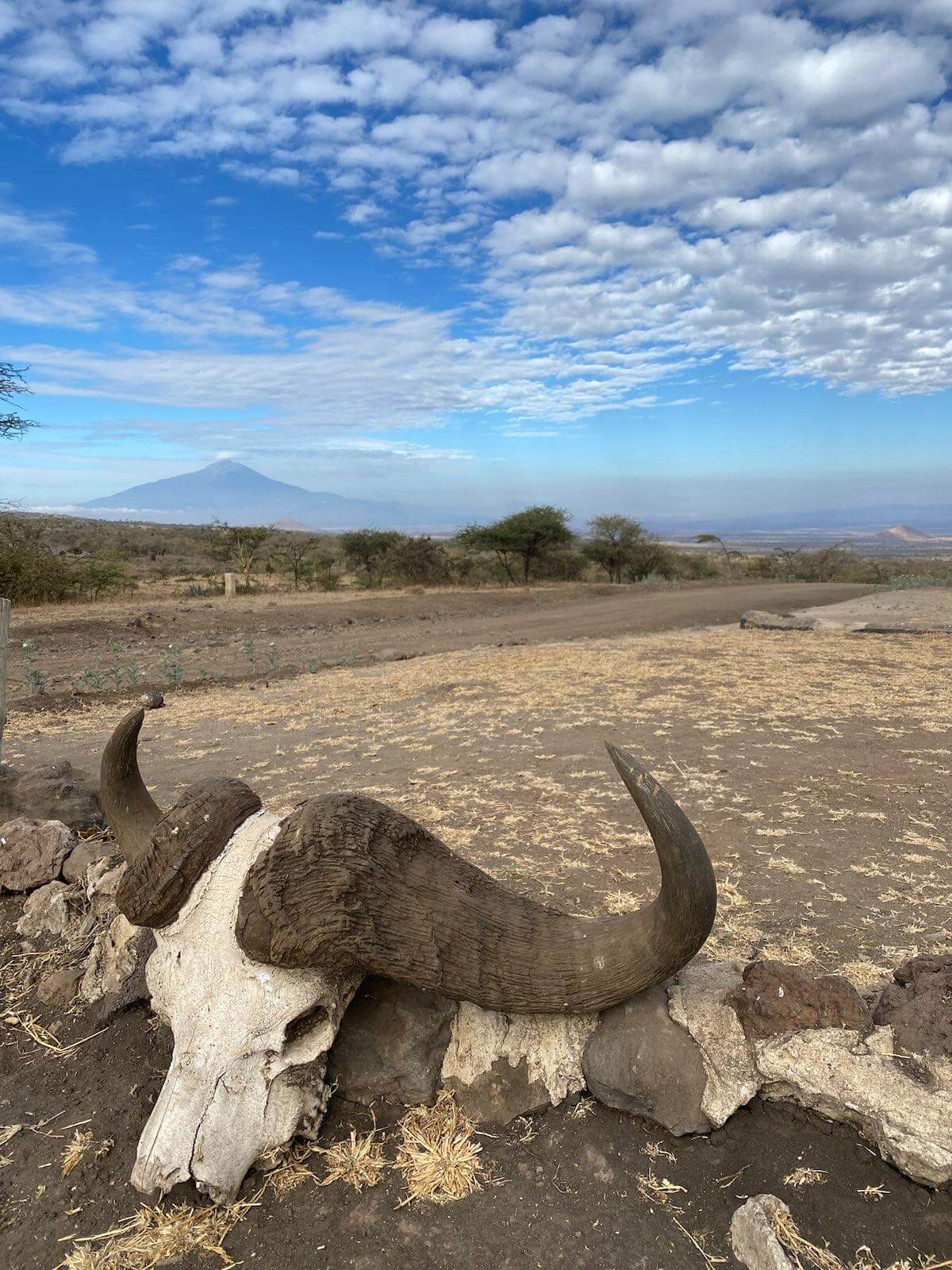
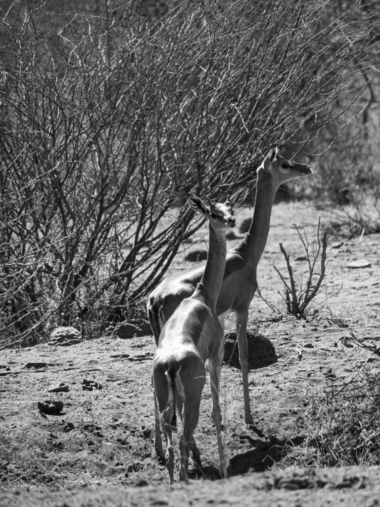
From a sight on our right, I feel like there is something wrong with my eyes. I can see some gazelles in front of us but they are elongated as if stretched out. A dim memory floats to the top. Ah! Gerenuk. Our first sighting ever of this unique antelope. We have only just entered the gerenuk’s ecological zone stretching north up to the horn of Africa. We stop the vehicle and enjoy watching the gerenuk who don’t appear to be overly frightened of us. They look like a mix of impala and springbok with the obviously elongated neck and legs. Gerenuk are browsers and prefer acacia leaves when available. They can stretch up on their hindlegs as much as 2 metres allowing them access to tasty morsels that their closer antelope brethren would struggle to reach.
The Gerenuk sighting has already made this Enduimet adventure well worth it!
The paper map of the Enduimet WMA shows a small lake. On our Maps.me app, there is a similiar water shape and so we head in that direction assuming more wildlife will be there. We try to follow the tracks of the official dirt roads drawn on the Enduimet map but struggle because they just don’t seem to be going where they should be going and there are often tracks going in multiple directions for no apparent reason.
Eventually, we come to what looks like the edge of the water shape. There is a ridge of sand a metre or so high in front of us which looks promising and so I drive the 4×4 hilux up the ridge and get a view from the top to the other side. Absolutely nothing. In August 2023, there is absolutely no water in the maps.me water shape and it looks like there hasn’t been any for a very, very long time based on the vegetation which looks very similiar in the water shape compared to all of the other areas.
We do however notice a line of trees and shrubs in the distance which to us signify a small stream or water source and so head in that direction. Not much found but we happily drive around the area further dropping in and out of clumps of acacia looking for any and all wildlife that may be hiding from us. We come across some Maasai herds people a few times and try to make a wide arc around them so as not to disturb their day. I almost drive over a wooden crop at one point.
Eventually, we admit happy defeat and head towards a view point which we have heard is very good for late afternoon viewing. Along the way, we stumble across a few roads and landmarks which are starting to make sense according to the hand-drawn Enduimet WMA map and on a whim we take a left. And there it is! The water shape. Unfortunately, not a very picturesque landmark, the Siya Pools turn out to be an old abandoned mine pit which has filled in with water. The local Maasai are currently driving their cattle herds towards it for a late afternoon drink and cool down.
So the water shape on maps.me and the hand drawn map are different! Later, after taking a look on some satellite imagery online, it looks like Lake Amboseli might stretch slightly into Tanzania from the north. Whether there is ever water anymore from this alkaline and often dry body of water has been difficult to determine. There was a drought in 2009 in the area which the land has reportedly struggled to recover from but I assume that wouldn’t be the reason for the now dry water shape on maps.me.
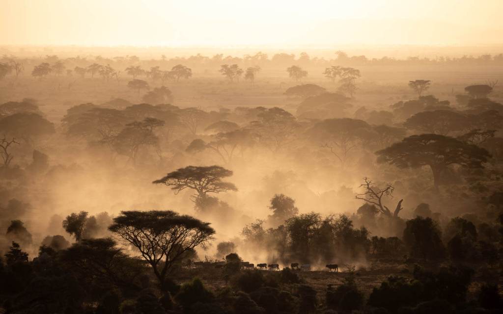
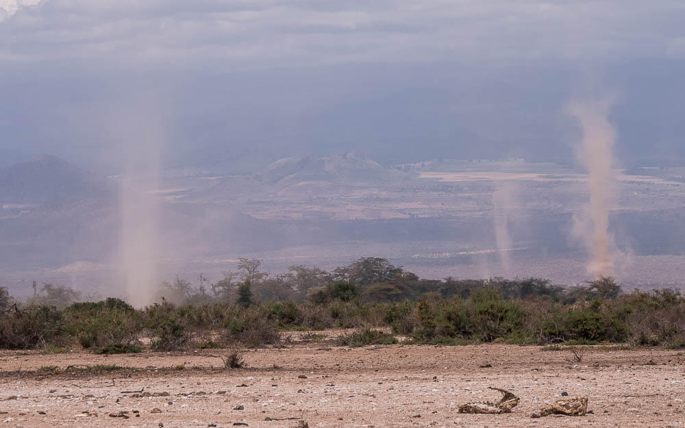
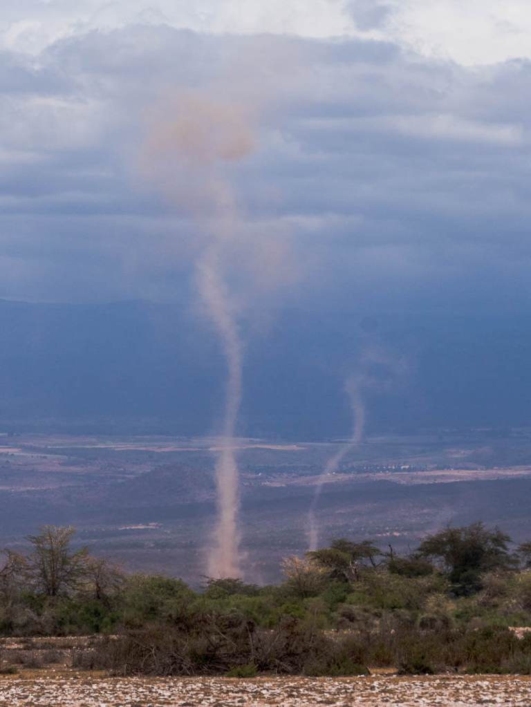
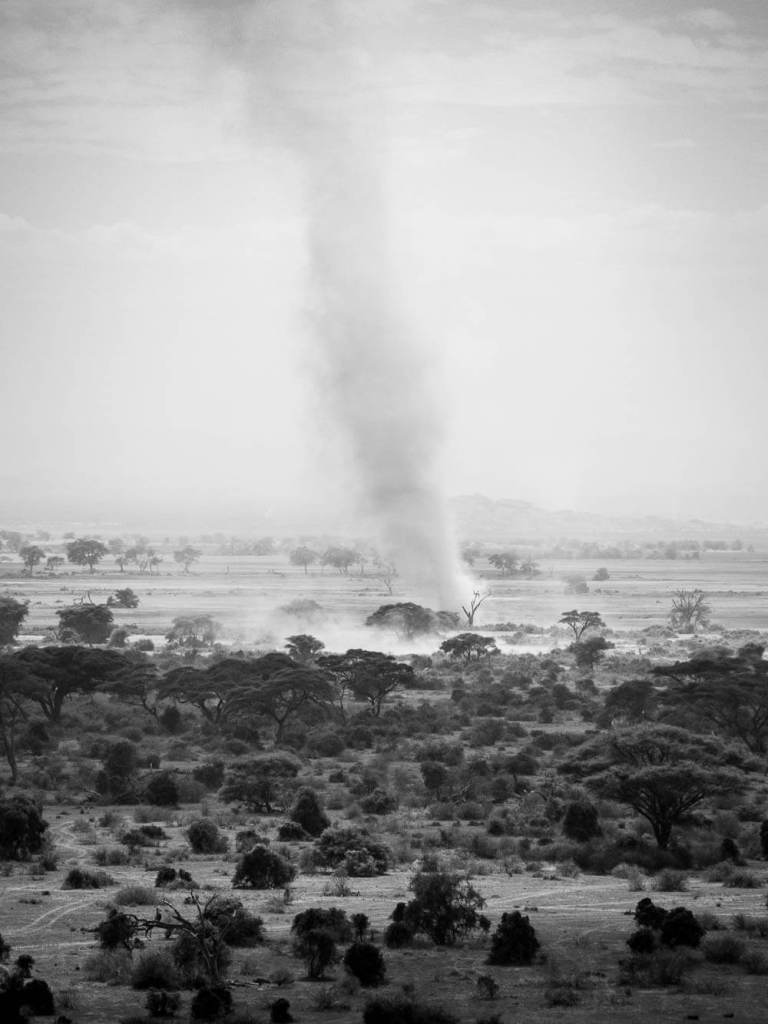
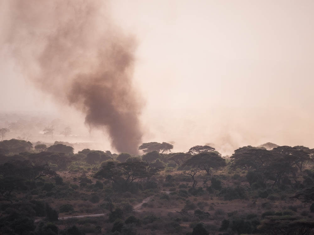
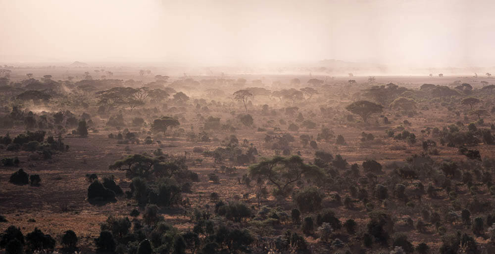
What follows is a fairly surreal bit of driving in and amongst dust devils towering to the sky as we drive towards the gargantuan dormant volcano, Kilimanjaro.
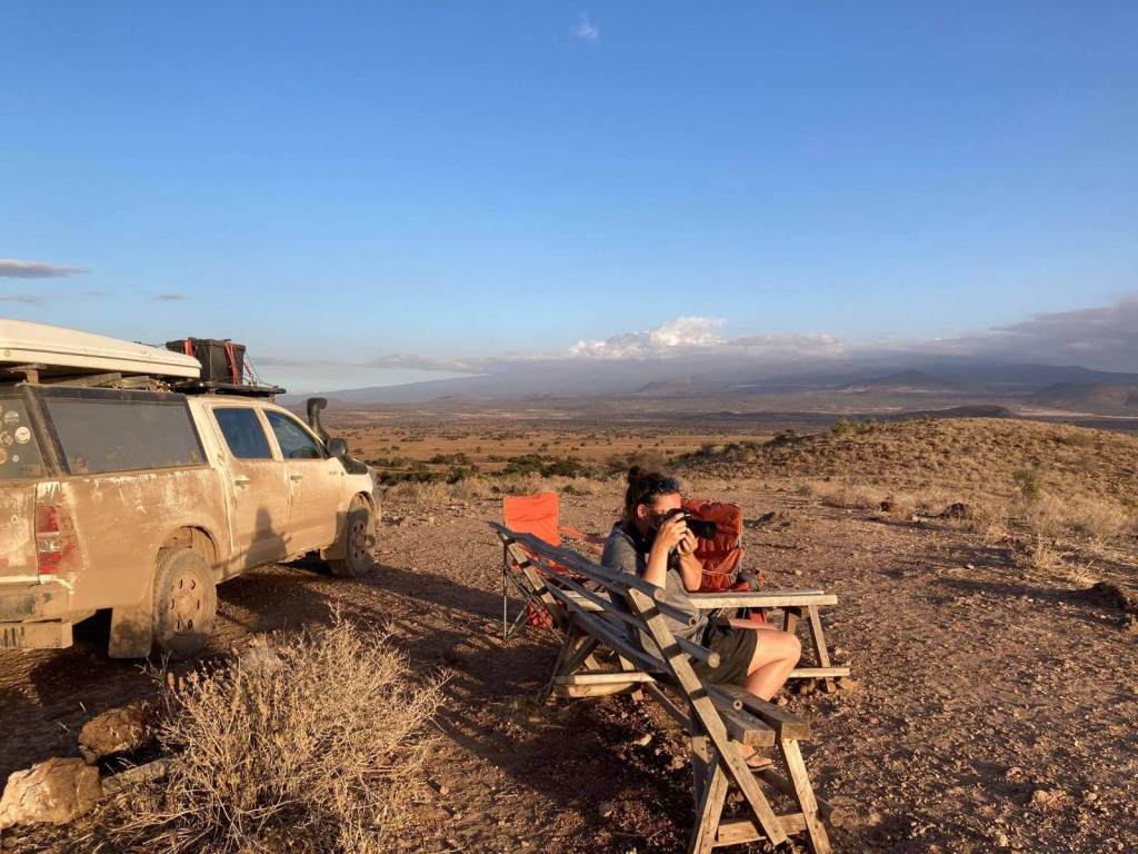
We find the hill marked as a good viewpoint on iOverlander and drive up to a small spot with benches just below an old and abandoned lodge. Wow! And what a view. Stretching out in front of us are the plains of the Maasai. A few towering dust devils are passing in front of us. Behind the whirling dervishes, in the distance and surrounding us, are the three iconic volcanoes. Mt Kilimanjaro, Mt Meru and Mt Longido.
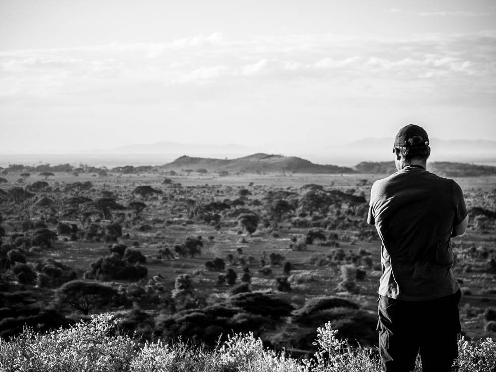
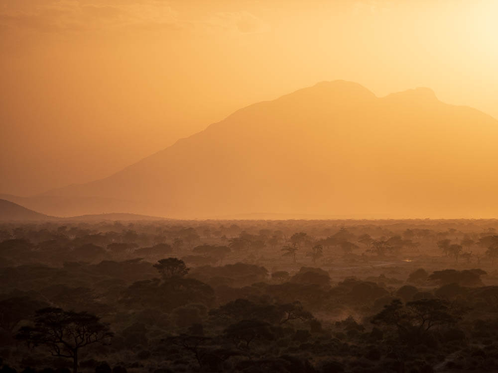
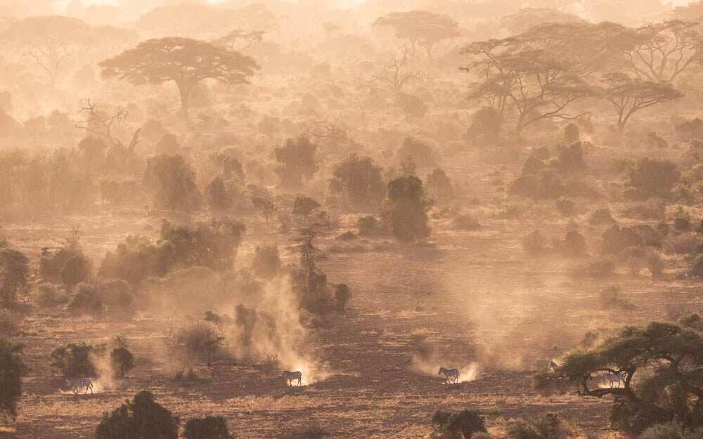
From on top of our viewpoint, we can see the Maasai herds people driving their cattle over the acacia plain to the west of us. A line of dust is trampled into the air as the cattle herd moves on. To the east, we can see groupings of elephant, zebra, giraffe and kudu ambling through and nibbling on the greener sections of tree and brush. Near the elephant herds are large white concrete blocks stretching out in a line marking the official border between Tanzania and Kenya.
A man on a motorbike is also kicking up a line of dust as he passes in front of us and then drives up the hill towards us. It turns out that he is our camp attendant for Chui Campsite. We agree to follow him to camp as the afternoon is still early enough. It’s close enough to return here for late afternoon viewings. We drive back down the road taking “shortcuts” away from the sections of difficult track. We had to switch over to low range 4×4 even on our pathfinder route.
The camp is perfect and we set up tables and chairs near to our camp attendant’s pitch before heading back to the viewpoint near the old lodge. The old lodge is tagged as Old Hemingway’s Camp online but no information beyond that.
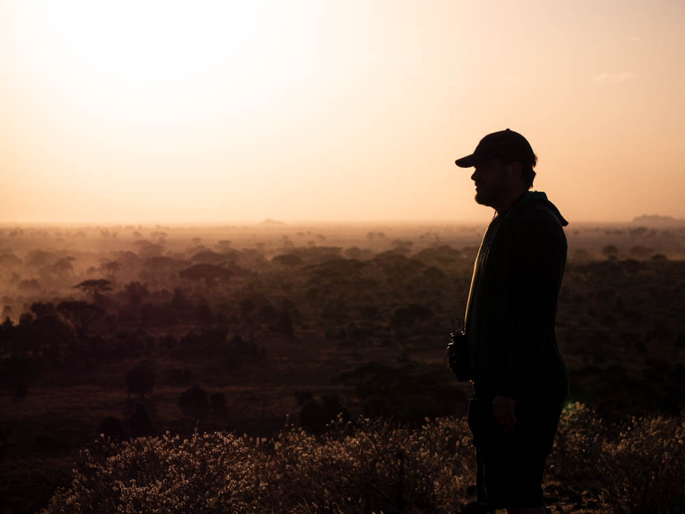
At the viewpoint, the late afternoon is spent with the sun setting over Longido and the banded colours of twilight over Meru and Kilimanjaro at height. Back at camp we sit for a while under the uninterrupted East African stars.
I unfortunately bought a few sour milk sachets instead of regular milk back in Moshi by mistake. With my incredible perspicacity, I ask our Maasai camp attendant whether he would like one of the sour milk sachets. The response is a very strong yes and so we find a happy medium in being able to treat the other Maasai community workers and rangers with our sour milk sachets.
One of the rangers stands with us at the viewpoint the next morning trying to spot game for us. We are able to hand over another sour milk sachet to him which he seems to appreciate. We have been keeping the sachets in our solar powered camping fridge. Both of the Maasai guys we give the sour milk to, pocket the sachets and so I’m not sure if they preferred them cold or warm.
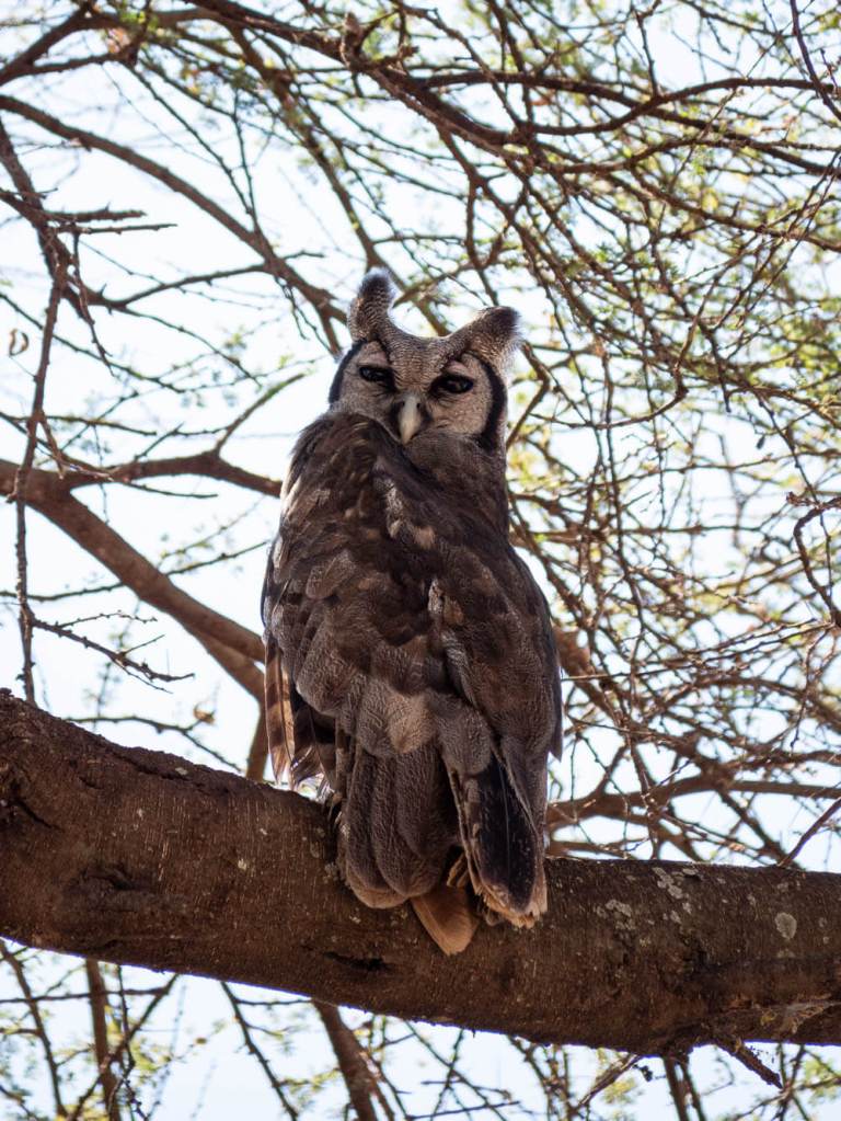
We drive in Enduimet WMA for a few more hours before heading out on our planned route to drive all the way around Mt Kilimanjaro. In Enduimet, Kirsty spots an eagle owl roosting in an acacia tree that we get to observe for a while. Impressive that she saw it! In the final kilometres leaving Enduimet, a small herd of Gerenuk gracefully run and jump a few hundred metres along the way with us. They almost seem friendly. We give big thanks to the Maasai attendants at the gate.

The drive around Kilimanjaro is beautiful. The altitude quickly increases and we find ourselves climbing to 2,080 metres. Remote villages and people live on the north side of the mountain in and alongside lush banana plantations, fields for cattle, forestry reserves and, once you are at a specific altitude, montane forests. The second largest peak of Mt Kilimanjaro rises up over the forests and the saddle leading from Mawenzi to Uhuru Peak. Mawenzi, along with Shira on the other side are extinct volcanic cones while Kibo (Uhuru Peak) is only dormant and could explode the 300 metres or so of ash cork stuck in its vent one day in the future.
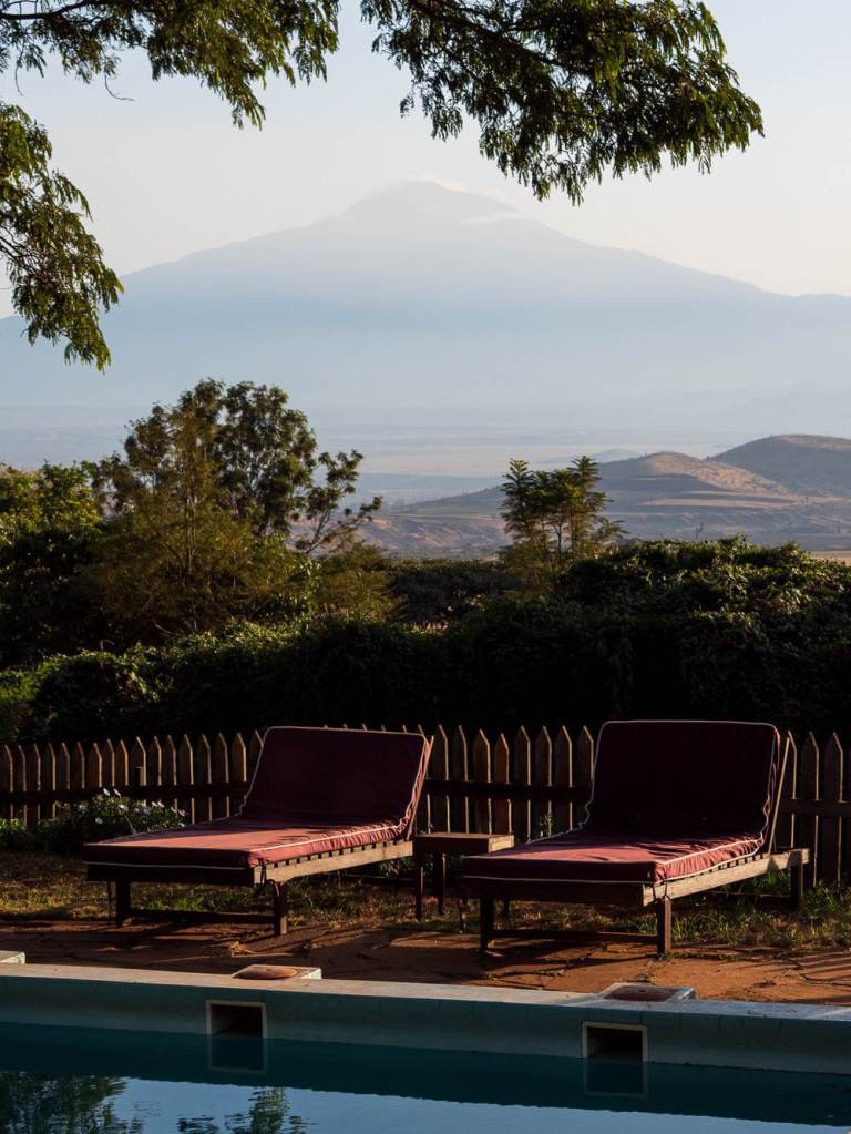
Around the east side of the mountain, we stop at Marangu to find some accommodation for the night but a drunk villager is follows us everywhere and so we decide to head off, not feeling safe enough to hang around. So, we end up back in Moshi. We try to find a few budget accommodation options which also provide security for the hilux but eventually have to give up and head for a campsite which I am sceptical of but can see no other choice. The campsite turns out to be one of the best we have ever stayed at, and certainly the most luxurious.
After some uncertain roads and turns, we find ourselves in a lush green tropical garden. The restaurant is good and does fair value meals. Most importantly, there is a hot shower with five different heads at various levels and angles. For two tired and dusty adventurers, the power shower is heaven and I am forced by Kirsty to remain at the campsite for the next 3 days. Something I don’t complain about overly. Each morning, the lodge staff bring us complimentary french toast and juice to soothe our dusty and travelled nerves. It is a tough life.
The Moshi campsite has some views of Kilimanjaro and we get one more view in before the clouds descend for the rest of the days we are there. Each afternoon, we go for a run in the neighbourhood with the clouds of Kilimanjaro always in sight.
A few supplies from Moshi, mostly vienna sausages, and it’s time to cross over to Kenya. We were told by a few travellers of the fantastically named Loitokitok border crossing which is another very easy and quick border like the one we used to enter Tanzania.

Leave a comment