Tsodilo Hills to the Caprivi Strip, March 2022
Mohembo Border Post
We’re crossing the Botswana/Namibia border at Mohembo. Mohembo is a very small township with a border and a river ferry. There is a larger town a few kilometres south called Shakawe where snacks, cool drinks, water, etc. can be purchased.
The main claim to fame of Mohembo is the Mohembo Ferry. Right alongside the Mohembo border post is the Cubango (Okavango) river and sitting on the bank is a questionable pontoon boat that you can drive your car on to. You then cross the mighty Okavango on the planks with steel drums (aka ferry). On the east side of the river there is then a gruelling drive into the Kalahari where you need to skirt around the fan of the delta and then find your way to Savuti, Linyanti and Chobe proper, areas of the national park system in the the north east. There are easier ways to get there for example from Maun or Kasane but an adventure in potential for sure. Some people have warned against us taking this route and so more research required. Even the Maun to Kasane route through Chobe national parks comes with some warnings as of early 2022 as some of the sections are apparently difficult to navigate during rainy season.
The border crossing is uneventful but meticulous because we are the first tourists to cross that day. The very bored officials go through all procedures in depth. Vaccination cards are accepted on both sides of the border and negative Covid tests are not required (late March 2022) – hurrah. We have our vehicle searched from top to bottom by four armed military personnel on the Namibian side. People with guns at gates are from now on ever present in our travels through public parks and border crossings in Namibia.
A quick note on gate passes! Always ask for the gate pass when going between borders in Africa (I’m not sure about other areas of the world). Each gate pass system is slightly different but a solemn ritual followed by all. The basic premise of the system appears to be that someone in the chain of command somewhere in the process will hand you a slip of paper with your registration number and number of people in the car. The slip of paper is often just a piece of torn paper. If you do not have this slip of paper with you on leaving customs and immigration, even with the stamps in your passport and the temporary import permit in your hands, you will not be allowed to leave the border control area. The person asking to see the slip of paper is also often a plain-clothes person apparently completely separate from border guards. On leaving Zimbabwe earlier in the month we were chased down by a plain-clothes person very upset that we hadn’t found him on our own initiative to hand over the piece of paper before leaving through the wide-open border gate.
We enter Namibia and are instantly within the Bwabwata National Park Core Area. Impala, zebra and giraffe leap, skitter and stroll alongside as we enter another country and excitedly consider what adventures may lie on the long Namibian road ahead of us.
Into the Caprivi Strip
The plan is to cover as much of Namibia as possible but to explore and appreciate each area at the same time. A difficult balance to achieve on any travels. Our ethos is slowly starting to develop and guidelines such as “at least three of the must-sees must be seen” and “at least one major national park per country must be explored.” Live music venues, etc have to be shelved in covid times. We are flexible and happy to meander through areas knowing that not everything can be seen. Most of our routes (if not destinations) are normally selected on the day of travel and can often change direction on a whim.
Namibia is a big country! It ranks number 35 out of 234 countries in the world in size. One and half times larger than France and twice the size of Germany. It is also in the top 10 for least densely populated at three people per square kilometre after the likes of Mongolia, Western Sahara and Greenland. The population of about 2.5 million people is found predominantly in the upper half of the country.
There are five main geographical areas in Namibia. The Bushveld which gets the most rain. The Bushveld lies in the North-East and the Caprivi Strip. The Kalahari Desert (not always desert) runs along most of the eastern border with Botswana. The Namib Desert (proper desert in my books) runs the length of the Namibian coast up to the Skeleton Coast. The Central Plateau runs North to South in the middle of the country. The Great Escarpment is a rising of land out of the Namib to the west of the Central Plateau.
Our plan is to initially explore the Caprivi Strip, spend some time on the Kavango River (known in Botswana as the Okavango), spend some significant time in Etosha National Park and then see some of the Skeleton Coast. Plans are enticingly uncertain following this. We are looking to spend about a month in the country.
A quick point: the Okavango river has three different names: Okavango (in Botswana) Kavango (in Namibia) and Cubango (in Angola). My apologies if I use them with no real sense of place following.
Our first stop shortly after crossing the border is Ndhovu Safari Lodge just outside of Bwabwata National Park. iOverlander reports a single camping spot on the banks of the Kavango at this lodge and we want it to be ours. Visions of tiger fishing from the banks of the mighty river stir the imagination. Turns out I am being majorly optimistic considering it is the rainy season and the river is fast and muddy.
We take the turnoff and pass a small township with a school and village shebeen. We wave at the kids and adults along the way excitedly. In front of us we see a large body of water.
In the dry season it looks like you might be able to cross the floodplain directly at this location to get to the lodge but the river is high now from the Angolan highlands rain pouring down from the north. The alluvial plain is indeed flooded and our accommodation is apparently on an island between the Cubango river and this body of water. The water is so high that we wonder about crossing the bridge in front of us. About two hundred metres of permeable dyke lie ahead. Mounds of dirt have been deposited directly across the flood plain’s course with openings every fifteen metres or so. Each opening has a bridge of poles spanning to the next dirt mound. We’re uncertain what is holding the poles up and our vehicle weighs over 2.5 tons all-in.
We see obvious tyre tracks in the sand and so decide to test the first bridge. The planks plink and plonk but reassuringly there’s no snapping sound nor tearing of metal beneath. The local villagers washing clothes, swimming and fishing nearby don’t even look up at the sight of us so we decide all is fine. This annual flooding is obviously a special event for the locals as we can see what appears to be the whole village out enjoying the waters in their own way. In the quieter waters of the backwash, Mom is washing clothes, Dad is fishing and the kids are screaming and splashing about. Egrets, heron and other water birds saunter through the waters whilst small fish and larger fins break the surface. We cross the significant stretch of water and enjoy a good dose of endorphins from both fear and the spectacular scenery.
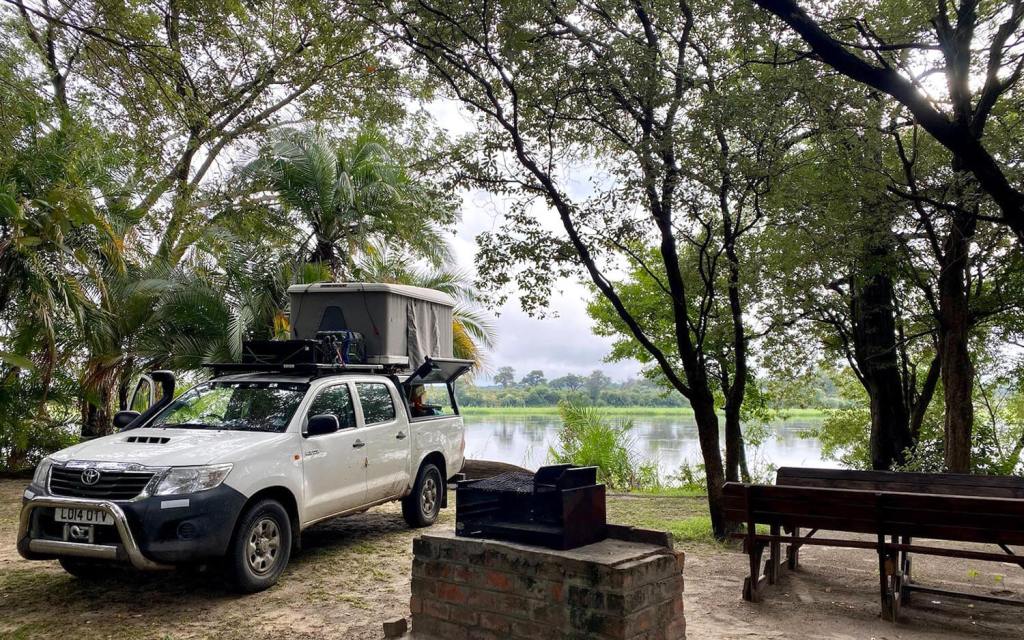
It turns out that the lodge has four camping pitches but, again, due to covid (and the season probably) none of them are taken so we grab the best pitch right on the banks of the Cubango river. A communal covered kitchen area with gas hot plates is provided. A major bonus is that directly across from us on the opposite bank of the river is another section of the Bwabwata National Park and on our arrival we can see sable, impala, warthog and other wildlife enjoying the salt licks and river running by. The manager of the lodge tells us to keep a look out because lion can often be seen on the opposite bank from the campsite.

I throw a lure a few times into the river but the vegetation is thick and it’s difficult to get varied casts. I’m sure the lodge would have let me fish off of one of their jetties if asked. The thick bushes and trees on the high river bank is a slight irritant but an obvious necessity to keep the pods of hippo grunting and splashing nearby from wandering around the campsite when the sun goes down. Our pitch is also on the high river bank giving a perfect view.
Rain comes down heavily again in the evening and we have a wet but enjoyable meal. Kirsty sneaks in a decidedly vegetarian lentil curry and I succumb to the spices alongside a Savanna Dry (southern African cider). The roof top tent stays dry the night through and we sleep deeply.

Leave a comment